Regions
Below are examples of two regions we are currently exploring for their geothermal potential.
Kazakhstan
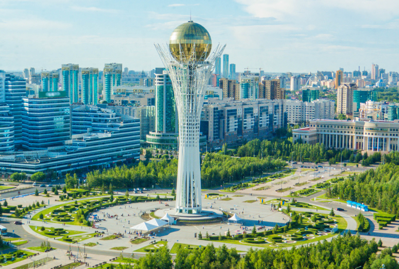
Kazakhstan has significant proven geothermal potential and strong political backing to undertake green energy initiatives as part of a climate change mitigation strategy and a sense of urgency to proceed.
There is undeniably great potential for Open and Closed-Loop Geothermal solutions in Kazakhstan throughout the country. The best uses envisaged are for power production, heating and cooling of buildings and agricultural applications.
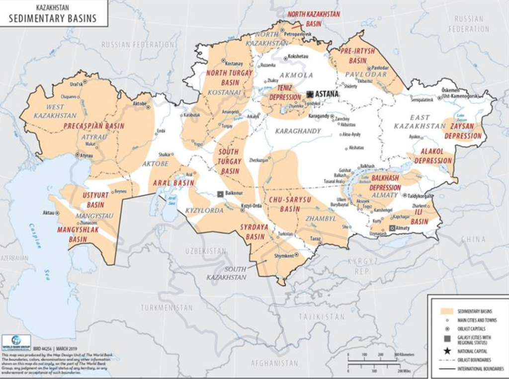
Kazakhstan has significant geothermal water resources, with total thermal capacity estimated at 520 megawatts thermal (MWth) under free-flow conditions, and up to 4,300 MWth with pumped systems. Proven resources for electricity production, particularly from the Cretaceous formations in southern and south-western regions like the Panfilov field, amount to 12 MWth. Key geothermal areas are located near Shymkent, Almaty, Kyzylorda, and along the Caspian Sea coast.
Kazakhstan possesses significant geothermal resources, predominantly of the sedimentary type. These resources have been identified through deep wells drilled for petroleum and gas exploration, which have also yielded hot water. Hot springs further confirm the presence of these geothermal reserves.
There is a growing opportunity to assess and map the full potential of Kazakhstan’s geothermal energy resources. This includes conducting detailed surveys to characterise geothermal fields and exploring the feasibility of large-scale utilisation for household energy and industrial processing needs.
Currently, hot water from springs and wells is used on a very limited scale in specific areas for direct purposes, but this represents just the beginning of what could be a broader adoption. By investing in geothermal exploration and infrastructure development, Kazakhstan could unlock a reliable and locally-sourced energy solution that meets both environmental goals and the energy needs of its population.
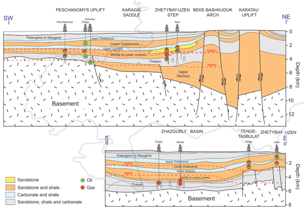
Cross-sections through the Mangyshlak Basin, shown to the left, demonstrate geothermal potential in the region. A range of temperatures recorded in this region suggests that this is a promising region for further exploration.
Source: Kozhagulova, A., Dillinger, A., Bayramov, E., Iltukov, R., Holbrook, J. and Fustic, M., 2023. Geothermal energy potential of the Mangyshlak Basin, western Kazakhstan: A preliminary assessment based on stratigraphy and temperature data. Geothermics, 109, p.102655.
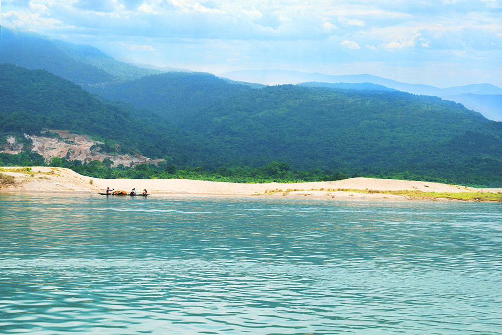
Bangladesh
Bangladesh is one of the lowest per capita energy consumption countries in the world. The country is a facing problem with shortage of energy and depended mainly on the natural gas and imported fossil fuel for electricity generation, industries, vehicles etc. Bangladesh has small reserves of oil and coal, but large natural gas resources. Commercial energy consumption is mostly natural gas (around 70%) followed by oil, hydropower and coal.
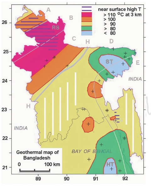
Electricity is the major source of power for country's most of the economic activities. Bangladesh's installed electric generation capacity was more than 10 GW. The country needs to develop alternate energy resources like renewable energy to meet up the demand. Bangladesh has no volcanic region but tectonically lies in the Northeastern Indian Plate near the edge of the Indian craton as well as Eurasian-Indian plate boundary which may associate with high geothermal gradients.
The geology of Bangladesh is affected by the country’s location, as Bangladesh is a riverine country. It is the eastern two-thirds of the Ganges and Brahmaputra river delta plain stretching to the north from the Bay of Bengal. While the eastern part of Bangladesh is the continuation of the frontal belt of the Indo-Burma Range. Bengal Delta is one of the largest deltas in the world. Geological evolution of Bengal Delta is related to the uplift of the Himalaya due to collision of Indian and Asian plates. The Bengal Delta is characterized by enormous sediment supply from Himalaya, rapid sedimentation and subsidence resulting in huge thickness of siliciclastic deltaic sediments.
Tectonically Bangladesh lies in the northeastern Indian Plate near the edge of the Indian craton. Stable Pre-Cambrian Platform and a huge geosynclinal basin in the southeast are dominating tectonic features of Bangladesh which are separated by a narrow northeast-southwest trending Hinge zone (Figure 2), currently known as palaeo continental slope (Salt et al. 1986). Stable Pre-Cambrian Platform covers the country to the west and northwest of the Hinge zone and is divided into three major zones: Rangpur Saddle, Bogra slope and Dinajpur slope (Figure 9). The thickness of sedimentary column on the stable shelf of Bengal Basin varies from less than 200 m to 10,000 m (Alam 1989).
Rangpur Saddle connects the Indian Shield with the Shillong and the Mikir Hills Massif resulting in uplifted basement with thin cover of sedimentary rocks. In Madhyapara area the basement is encountered at 130 m depth and overlain by Plio-Pliestocene sediments. The northern and southern slopes of Rangpur Saddle are quite gentle and the basement plunges gently from Madhyapara towards the southeast up to the Hinge zone. It separates the Bengal Foredeep and the Himalayan Foredeep.
Kenya
Energy is one of the key enablers of Kenya’s Vision 2030 and the Big 4 Agenda development programmes. Kenya treats energy security as a matter of national priority. The Third Medium Plan 2017-2022 identifies energy as the country’s driver into “a newly-industrialising, middle-income economy, providing a high quality of life to all its citizens in a clean and secure environment.”
Kenya considers access to competitively-priced, reliable, quality, safe and sustainable energy as an essential ingredient for the country’s socio-economic development.
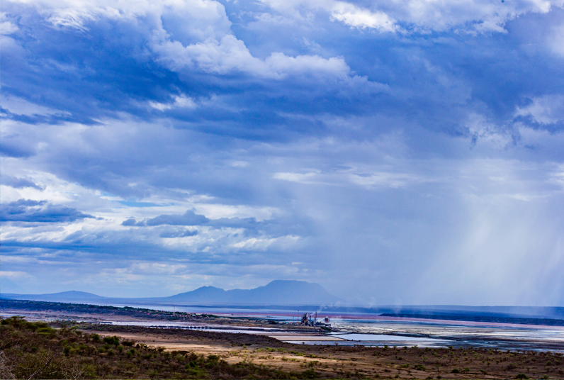
Geothermal power plants have a prominent place in Kenya’s overarching development plans. These include the Vision 2030, the NCCAP, and the current ‘5000+ MW in 40 months initiative’. Geothermal power has the potential to provide reliable, cost-competitive, baseload power with a small carbon footprint, and reduces vulnerability to climate by diversifying power supply away from hydropower, which currently provides the majority of Kenya’s electricity.
Kenya has set out ambitious targets for geothermal energy. It aims to expand its geothermal power production capacity to 5,000 MW by 2030, with a medium-term target of installing 1,887 MW by 2017. Although there is significant political will and ambition, reaching these ambitious goals is a major challenge.
Kenya leads in Geothermal Development in Africa and is in the top 10 globally.
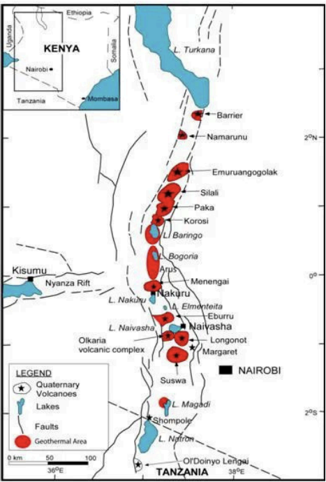
High-temperature geothermal prospects in Kenya occur along the East Africa Rift System.
- Current installed capacity – about 985MWe.
- Kenya’s total potential – is about 10,000 MWe.
Kenya has several geothermal fields, namely: Olkaria, Menengai, Barrier, Namarunu, Emuruangongolak, Silali, Paka, Korosi, Baringo, Bogoria, Arus, Eburru, Longonot, Suswa, Lake Magadi, Homa Hills, Mwananyamala, and Badlands.
Only Olkaria & Eburru Geothermal Field, so far, are generating geothermal power. Most of the other fields are in various phases of development.
